Methodology
|
The structure of an EIA process is dictated primarily by the need to accommodate the key issues. From a technical point of view, EIA can be considered as a data management process having three specific components (i) identification and collation of appropriate information necessary for a particular decision (ii) determination of changes in select environmental parameters resulting from implementation of proposed project and their comparison with situation likely to accrue without the proposal and (iii) finally recording and analysing changes and their significance. For the ecological assessment of linear expansion projects such as CCKT Pipeline Project, preparation of adequate database from the ecological and biological perspective is a foremost step to quantify the impacts on important floral and faunal species. The species, whether animal or plant would generally be regarded `important' (i) if it is commercially or recreationally valuable (ii) if it is rare or endangered or (iii) if it affects the well being of some important species within criteria (i) or (ii) above or (iv) if it is critical to the nature and functions of the ecological systems (USAEC, 1973). The impacts of pipeline project on natural ecosystem that are likely to be of more general nature include related changes in the community types and their geographical distribution. Specific impacts may include changes in life cycle of rare and endangered species. This section of the report is devoted to identification of the steps that would allow collection and collation of relevant information for determining impacts of CCKT Pipeline Project on wildlife species and their habitats. The following are the specific steps that have been identified to address the specific objectives of the study outlined in the preceding section of this report and to also accomplish the tasks specified in the scope of this EIA study. i. Comprehensive overview of both, the proposed projects and its potential impacts. ii. Consideration of proposed activities in all phases of the project and identification of critical environmental concerns iii. Identification of primary category of habitats. iv. Quantitative and qualitative assessment of impacts wherever possible. v. Provide project evaluation, incorporating environmental safeguards and mitigatory strategies. The following have been the specific sources of information and database needed for the assessment of impacts of CCKT Pipeline Project. 2.1 DOCUMENTED INFORMATION 2.2 RECONNAISSANCE
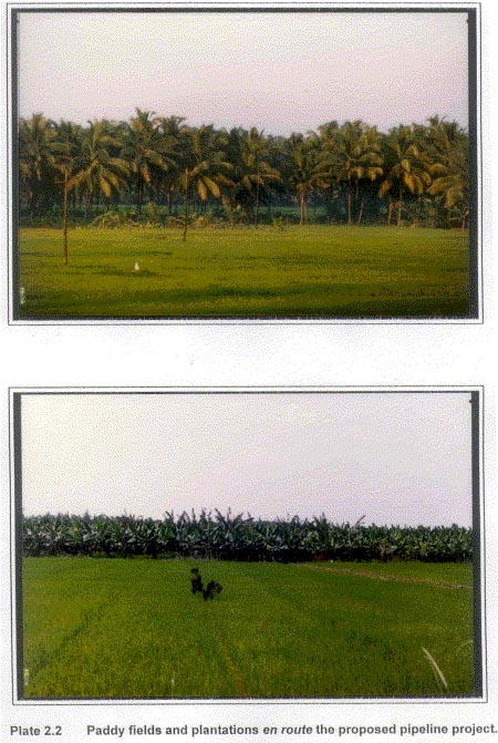
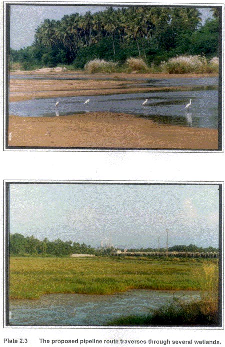
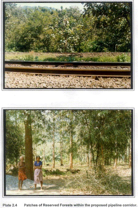
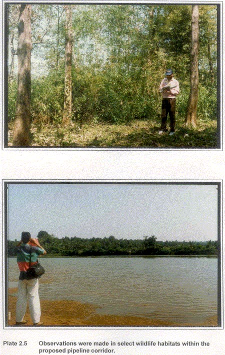
Survey points were located to cover all the representative habitat categories within the pipeline corridor. In all, seventeen points were surveyed during the reconnaissance phase. Target notes were prepared in brief for each survey point. These notes provided a broad assessments of the ecological significance of aquatic and terrestrial habitats en route the pipeline. As is evident from the route of the pipeline, a total of 159 km length of pipeline traverses through paddy fields and plantations (banana, coconut and rubber) (refer Table 1.1). Another 153 km of the pipeline passes through cultivated areas (Plate 2.2). The area of pipeline corridor supporting the above landuse categories are not being considered for extensive field investigations as these do not fall within the scope of work outlined for this study. The area under the aquatic and terrestrial wildlife habitats include areas under rivers, reservoirs, marshes (Plate 2.3) and Reserved Forests (Plate 2.4). The results of the rapid assessment survey (reconnaissance) are presented in the Table 2.1. Based on the Table 2.1, the following wildlife habitats were considered for the intensive studies for the assessment of impacts of the CCKT Pipeline Project.
Aquatic habitats The wetlands identified for detailed investigations within the proposed pipeline corridor fall into the following three categories: (i) Rivers: Seven major rivers en route the pipeline have been identified for evaluation of impacts on aquatic wildlife values. These rivers include Kaniyampuzha, South Periyar, North Periyar, Chalakudi, Kurumali, Bharatapuzha and Amaravati. (ii) Reservoirs: Reservoir of Walayar irrigation dam is the only major reservoir within the pipeline corridor. (iii) Marshes: The marshland area on the southern side of the BPCL complex at Irumbanam is an important wetland. Table 2.1 Points surveyed along the CCKT Pipeline route.
Terrestrial habitats 2.3 INTENSIVE STUDIES The secondary information and database thus generated on ecological and biological attributes of the project environment, provided the key information on pre-project baseline scenario.
|
Last Updated: October 8, 2015


