
Study Sites and Objectives
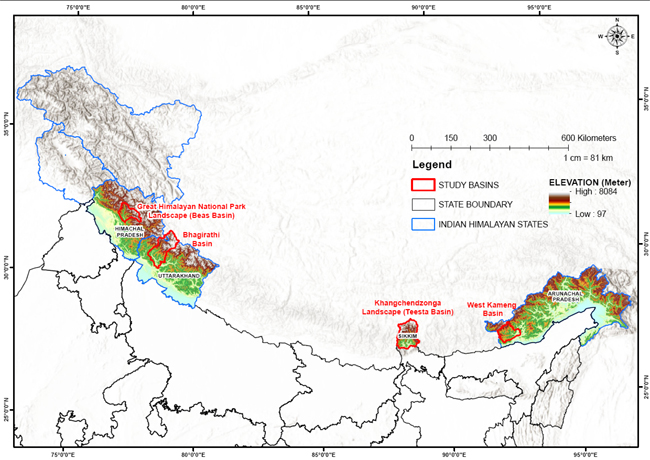
The long-term monitoring study areas in Phase I focused on three major river basins- Beas (Himachal Pradesh) in North-western Himalaya, Bhagirathi (Uttarakhand) in Western Himalaya and Teesta (Sikkim) in Eastern Himalaya. The Phase II proposes to expand the geographic scope of work by including Kameng river basin (Arunachal Pradesh), with the following objectives to:
- Generate spatially explicit information on observed and predicted impacts of climate change on wildlife populations throughout the longitudinal and elevational gradient in the IHR
- Generate microclimatic pattern through automated fine scale data generation (data loggers for terrestrial and aquatic environments, permanent sampling plots and Open Top Chambers) for the assessment of climate impact on wildlife species in the IH
- Assess ecosystem health under climate change scenario and evaluate the change in flow of ecosystem services and the anthropogenic pressure in selected landscapes of the IHR
- Characterize the landscape, identified as climate refugia, important for survival of key wildlife species populations under present and future climate change scenario using suitable modelling approaches
- Establish a Spatial Database Infrastructure (SDI) capable of storing large robust dataset and develop integrated Web based Decision support system (Wb-DSS) for visualization, strategic knowledge and climate change adaptation policy formulation
- Establish permanent monitoring sites / plots and implement long-term monitoring programme by trained local stakeholders
Last Updated: October 20, 2022


