Project profile
|
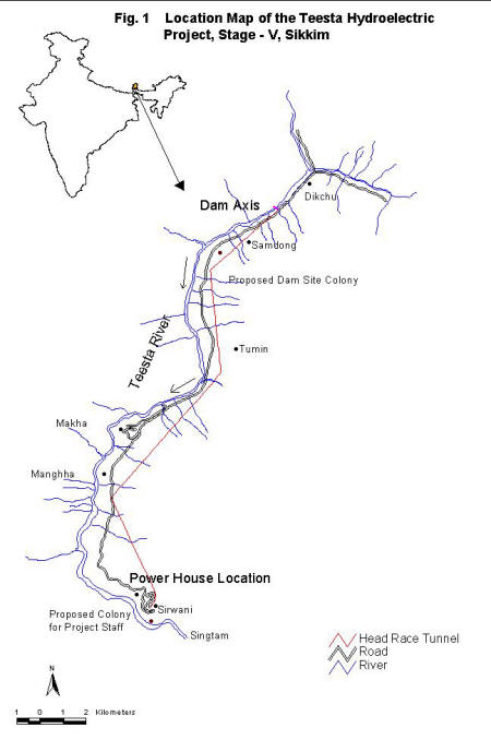
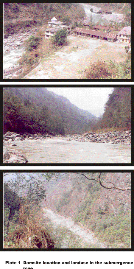
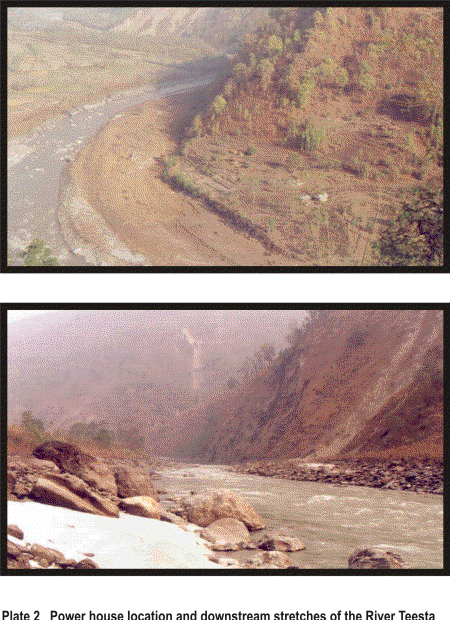
The 510 MW, Teesta Hydroelectric Project, Stage - V proposed on Teesta river in Sikkim is one of the largest projects undertaken by NHPC to meet the power requirements for the eastern regional grid. The Teesta Hydroelectric Project, Stage - V, which is a run of the river scheme, has been planned for commissioning by the year 2007-08. 2.1 PROJECT LOCATION The proposed Teesta Hydroelectric Project, Stage - V is located in eastern and northern districts of state of Sikkim between latitude 27o20’N to 28o15’N and longitude 88o00’E (Fig.1). A 96.45m high concrete gravity dam is proposed to be constructed two kilometers downstream of the confluence point of Teesta with Dikchu nallah (Plate 1 & 2). The underground Power house site is proposed to be located at Serwani village which is 5 km away from Singtam on Singtam - Mangan state highway. Two diversion tunnels are proposed on the right bank to divert the river water during construction of the main dam, which is located about 2 km downstream of confluence of Teesta river and Dikchu nallah.
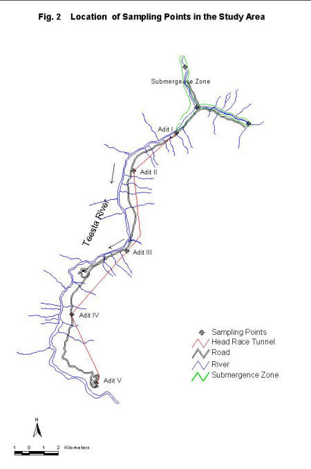
2.2 ECOLOGICAL SETTING The Project area falls in the Biogeographic Province 2C (Rodgers and Panwar, 1988). The proposed Project area covers the stretch of nearly 23 km along river Teesta between Serwani village and Dikchu village. The entire area is inhabited by several villages with agricultural lands, village farms and pasture lands dominating the landuse. The Singtam - Mangan Road is the major motorable road that provides access to Project area. The Project area exhibits low forest cover because of biotic influences associated with human interspersions and degradation caused by extensive infrastructural development that has been in progress for a long time. The dam will be constructed two kilometers downstream from the confluence of river Teesta and Dikchu nallah. The dependable discharge available throughout the year has been estimated as 60 cumecs and the gross head available to be 200 meters. Areas 5 km upstream on Tessta river from dam axis and 1 km upstream on Dikchu nallah from confluence point of Teesta and Dickhu will get submerged. The total area to be submerged is estimated to be around 67 ha. The underground Power house will be located near Singtam about 4 km upstream of the confluence of Rongnichu with Teesta and is expected to generate 100 MW of firm power with a installed capacity of 540 MW. The watershed divide of the Teesta river in Sikkim is marked by the state’s international boundary with Nepal, Tibet and Bhutan. The total catchment area of river Teesta is 12,650 km2 of which roughly 9350 Km2 lies in hilly region. The upper and middle portions of the catchment are much wider compared to lower one. The catchment area of Teesta river upto proposed dam site of Teesta Hydroelectric Project, Stage - V at Dikchu, which is about 2.67 km downstream of Teesta Dikchu confluence is 4307 km2 and is fern shaped (Fig. 2).
In the Project area, the river Teesta, generally flows in southwesterly direction and carves out a narrow gorge. The river cuts through the low-grade metamorphic sequence of quartzite and phyllites of Lesser Himalayan domain. The Project area falls in Zone IV of the Seismic Zoning Map of India as per ISI 1893-1975. 2.3 SALIENT FEATURES OF THE PROJECT Teesta Project, Stage - V envisages generation of 510 MW power for the eastern regional grid by utilising water of river Teesta from the stretch between Dikchu bridge to Serwani Village. The catchment area at dam site is 4307 km2. This is in addition to the free drainage area of 2020 km2 as indicated in the EIA Report (Anon., 1998). Under this Project, the following construction related works are envisaged: 1. A 96.45 m high and 182.50 m long concrete gravity dam. The salient features of the project are summarized below: DESCRIPTION LOCATION
RESERVOIR
Several infrastructural developments that are associated with the Project are planned at various sites and locations. Some of these proposed developments include: 1. Project office and residential/non residential complexes Apart from the development of roads proposed in the area under the Project, all the other peripheral developments would largely be confined to the land acquired by the Project Authorities. It is possible that the Project Authorities would acquire forest/private land for road up gradation and expansion. The details of road to be upgraded or constructed for the implementation of the Project are provided in Table 2.1. The width of the roads proposed to be constructed would be generally between 4.5 to 8 m as indicated in the feasibility report of NHPC (Anon., 1998). Table 2.1 Details of new roads to be constructed in the Project area.
Besides the road communication network, one 100m X 100m size helipad is proposed to be built on the left bank of the river in front of Power house site. |
||||||||||||||||||||||||||||||||||||||||||||||||||||||||||||||||||||||||||||||||||||||||||||||||||||||||||||||||||||||||||||||||||||||||||||||||||||||||||||||||||||||||||||||||||||||||||||||||||||||||||||||||||||
Last Updated: October 5, 2015


