Methods
|
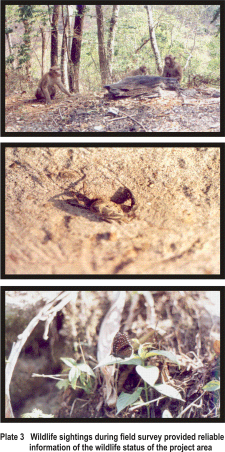
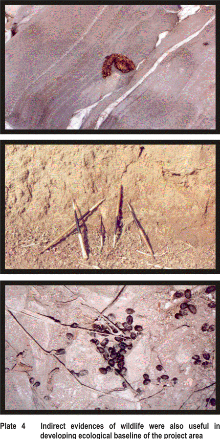
Establishing ecological baseline is the most important requisite for ecological assessment of any developmental initiative. Application of robust, reliable and rapid methodologies that employ basic tools for data collection are necessary. Ecological field surveys, are pragmatic approaches for collecting primary and secondary information on habitats, species and communities and on other relevant ecological parameters to be able to accomplish the scoping of issues. This helps in the identification of the thrust areas that demand considerations in impact evaluation. The methodological approaches adopted for the ecological assessment of Teesta Hydroelectric Project, Stage - V are discussed below. 3.1 DOCUMENTED INFORMATION The description of the Project profile drawings of the project design and Survey of India (1:50,000) toposheets provided by the authorities of NHPC, enhanced the basic understanding of the Project environment and activities associated with construction and operational phases of the Project. Extensive literature survey was done to collect relevant information on floral and faunal values of the area. Secondary sources of information included scientific and technical reports, records of Working Plan of the State Forest Department and reports of wildlife surveys from local and state agencies. Discussions with wildlife experts and ecologists of G. B. Pant Institute of Himalayan Environment and Development, Sikkim Unit, Botanical Survey of India eastern region, W.W.F Sikkim chapter and officials of Sikkim State Forest Department helped a great deal in compilation of the ecological information of the entire area, prior to initiation of extensive field studies. 3.2 RECONNAISSANCE Reconnaissance survey of the entire Project area was conducted along with the officials of NHPC. This helped a great deal in identifying sites and parameters that were required to be studied in greater detail subsequently during the course of extensive field investigations. 3.3 DELINEATION OF STUDY AREA The spatial limits of the study area for ecological assessment need to be carefully determined for collection of meaningful information within the representative areas in a reasonable time frame. Observations on the ecological characteristics of the study area, assessment of the status of floral and faunal diversity and habitat quality and the evaluation of the conservation significance of the wildlife values of the Project area can then be attempted within defined zones. For this Project, the study area comprised of submergence zone and the stretch of river Teesta downstream between dam and Power house locations. Based on the reconnaissance, the Project area was further stratified into six sampling units along the river Teesta for intensive study of floral and faunal values of the Project area. NHPC has identified five Adit points for the construction of head race tunnel, that originate from the dam axis (Fig.2). These were considered potential disturbance zones since most of the construction related activities on above ground would be localized within these zones. These Adit points were marked on map (1: 25,000 scale) and were surveyed during the reconnaissance of the Project area. 3.4 ECOLOGICAL STUDIES 3.4.1 Habitat Assessment The term habitat has been used here in a broader sense for general land cover rather than for a particular species. A rapid habitat assessment was carried out along the river Teesta. The Singtam – Dikchu road was used as survey reference line. The terrain type and land cover categories on the banks of river Teesta were assessed by sampling at every 100 m. The terrain type was assigned one of the following categories: stable rocks, loose rocks, boulders and eroded slopes. The land cover was assigned one of the categories of scrub vegetation, grassy slopes, scrub and grassy slopes mixed agriculture land and barren land. 3.4.2 Flora and Vegetation Both the banks of Teesta river within the Project area were traversed on foot by the team. Books such as “Trees of the Sikkim Himalaya” (Rai & Rai, 1994), “The Trees of Northern Bengal” (Cowan & Cowan, 1929), “Medicinal Plants of the Sikkim Himalaya” ( Rai & Sharma, 1994), “The Orchids of the Sikkim Himalaya” ( King & Pantling, 1898) and “A Preliminary Inventory of Orchidaceae in India” (Jain & Mehrotra, 1984) were used to identify species and acquire information on the floral diversity along the search path. Specimens of unidentified species were collected and dried using plant press for further validation and verification by the Botanist of G.B Pant Institute of Himalayan Environment and Development, Sikkim Unit and Incharge of the Herbaria, Sikkim State Forest Department, Gangtok. The detailed analysis of flora was attempted based on available literature on the rare and endemic plants of the region. During the floristic surveys, notes were prepared on the habit and habitat of the species. The floral survey was conducted in four areas viz., (i) Submergence zone, left bank, (ii) Area above submergence zone on left bank, (iii) All the five Adit points and the two banks near these Adit points and banks of the river near Power house site location. The vegetation of the Project area was analysed for frequency and density of various species by using circular plots of 10 m radius (Mueller – Dombois and Ellerberg, 1974). For ethnobotanical studies, information was recorded based on direct observations and personal interviews of local people and field assistants during the field surveys. Ethnobotanical information was also supplemented from literature sources on this subject. Of the various sources, the following were the most important sources that were consulted: (i) ‘People and Plants’ “conservation manual” (Martin, 1995), (ii) “Sikkim: problems and prospects of development” (Dasgupta, 1992) and (iii) “Medicinal Plants of the Sikkim Himalaya” (Rai & Sharma, 1994). We also interviewed a few local quacks and local traders for information on medicinal use of plants, and their availability from within the Project area. 3.4.3 Fauna 3.4.3.1 Mammals Rapid surveys were carried out in the submergence and down stream zones upto Sirwani village. These surveys were conducted in habitats along the riverside. Intensive surveys were conducted in areas, which would be subjected to higher degree of disturbance by Project related activities. For this, the Adit points marked by NHPC as their construction points for underground tunnel were used. Data on the presence/absence of the different faunal species in the Project area was recorded largely based on direct and indirect evidence such as tracks, spoors, dung and calls (Plate 3 & 4). Secondary information sources such as published information, unpublished reports, departmental records, personal communication and informal interviews with officials of various departments and villagers were also taken into account for supplementing primary data collected during field studies. The stretches of river banks in the submergence and down stream zones, that were accessible, were surveyed for the presence of different faunal species. Standard field guides were used for identification of mammals during the surveys (Prater, 1980).
3.4.3.2 Birds Bird surveys were conducted at the sampling points marked for intensive study. While traversing the area, birds were identified either by direct sighting or by calls. Casual observations were also recorded as and when the team moved through the study area. Field guide by Ali & Ripley, (1983) was used to identify bird species. Existing checklists of avian species (Anon., 1998) of the Project area was also consulted and validated. 3.4.3.3 Fish Information of fish fauna was mainly collected by visiting the local fish markets and by making casual observations of fish catch by local fishermen while traversing the banks of river Teesta for conducting mammal surveys. Interviews with local fishermen were also conducted and information on the different types of fishes, which get caught in their nets, was collected. 3.4.3.4 Butterflies Study of butterfly fauna of the area was the main thrust of this study as the area is endowed with rich lepidopteran diversity. The entire study area was stratified on the basis of different disturbance zones (Submergence zone, Adit I, Adit II, Adit III, Adit IV and Adit V). Data was collected during 17th March to 7th April, 1999 principally from the areas mentioned above. At each of the sites, butterfly counts were conducted from 7:00 AM to 3:00 PM in about 4 km stretch of area that was traversed on foot every day. All species within 5 m square in front of the recorder were counted. Where species could not be approached very close, 8X20 binoculars were used to identify species. Smaller butterflies were caught with the help of butterfly nets and were released after their identification. A total number of 18 such transects were walked, three transects at each site. Standard field guide by Haribal 1993; Wynter Blyth 1982 and Evans, 1932 were used to aid in the species identification. |
Last Updated: October 5, 2015


