|
ENVIRONMENTAL IMPACT ASSESSMENT
An Environmental Impact Assessment (EIA) is an event or an effect which results from a prior event (Wathern, 1989). The characteristics of impacts are as follows:
"An Impact has both spatial and temporal components and can be described as the change in an environmental parameters, over a specific period and within a defined area resulting from a particular activity compared with the situation which would have occurred, had the activity had not been initiated".
The following are some other definitions that clearly outline the purpose of environmental assessment for this project and also lays emphasis on the procedural steps that would have to be adopted for such a study.
"An assessment consists in establishing quantitative values for selected parameters, which indicate the quality of the environment before, during and after the action" (Anon, 1994).
"EIA is a technique and a process by which information about the environmental effect of a project is collected, both by the developer and from other sources, and taken into account by the planning authority in forming their judgement on whether the development should go ahead" (Ministry of Environment and Forests, Government of India).
The EIA studies for this project is based on the premise that the project related changes can lead to both negative and positive impacts: These could be a result of changes in existing habitat, species composition, population density and diversity of plants and animal species and different ecological processes (nutrient cycling, energy flow, production, eutrophication and succession) or the creation of new habitats and the micro habitats in the post project scenario.
Identification of ecologically sensitive areas (terrestrial and aquatic wildlife habitats) on which the impacts of the proposed project are anticipated, determining baseline status with regard to identified elements through sampling and field investigations, simulating resulting changes in different parameters and the aggregation of these changes in determining the resultant environmental impacts on wildlife and bio-habitats form the basis of this EIA study.
2.1 THE MACRO LEVEL ASSESSMENT
This involves collection of information on project (design and detail) and the areas of interest from all possible sources to enhance our understanding of the engineering sense for the justification of the project on one hand and the related impacts of such project on select sites and parameters on the other hand. Relevant toposheets of the area on a scale of 1:50,000 and cartographic drawings of pipeline route corridors were extensively referred for the identification of areas of interest along the referenced survey points. Working plans and animal census records obtained from the Maharashtra Forest Department were referred for preliminary information on forest structure and composition and wildlife values of the areas en route the pipeline expansion. Project documents and feasibility reports (prepared by BPCL) were consulted extensively for details on route selection, construction technology and all other actions involved in the project implementation.
Published information from scientific documents and all other documents (EIL 1993, VIMTA LAB, 1993) proved useful data sources for formulating the methodologies.
2.2 RECONNAISSANCE OF THE PROJECT AREA
"Reconnaissance" provide relatively rapidly, a record of semi- natural vegetation and wildlife habitats over large areas of country side. With this in view, a reconnaissance of the Bombay-Manmad Pipeline Project area was undertaken during the month of December 1994 to assign relative importance to different sites along the pipeline corridor (Table 2.1). At each reference point information about nearest survey point number, landuse pattern and wildlife values were collected (Plate 2.1). Based on this, areas of ecological interest along the entire length of pipeline corridor were identified as potential sites for intensive studies for assessment of project related impacts.
Table 2.1 Reference points surveyed along Bombay-Manmad Pipeline Route
|
Sr. No.
|
Nearest survey point number
|
Location
|
Landuse category/ Legal Status
|
Wildlife Status
|
Remark
|
|
1
|
TP 219-220
|
Thane
|
Creek (Ulhas)
|
+
|
Perennial
|
|
2
|
TP 271-278
|
Yelkund
|
Protected forest
|
-
|
Degraded
|
|
3
|
TP 316-317
|
|
River (Kumbheri)
|
-
|
Seasonal
|
|
4
|
TP 337
|
Koshimbi
|
Protected forest
|
-
|
Degraded
|
|
5
|
TP 349
|
Kasane
|
Protected forest
|
-
|
Degraded
|
|
6
|
TP 378-388
|
|
River (Bhatasa)
|
-
|
Seasonal
|
|
7
|
TP 383-400
|
|
Reserved forest
|
-
|
Fairly dense forest (ht.10 m)
|
|
8
|
TP 437-441
|
Cherpoli
|
Protected forest
|
-
|
Degraded (ht. 2 m)
|
|
9
|
TP 451-457
|
Cherpoli
|
Reserved forest
|
-
|
Teak plantation (ht.10 m)
|
|
10
|
TP 479
|
Sakharoli
|
Protected forest
|
-
|
Degraded, forest (ht.15 m)
|
|
11
|
TP 492
|
Kanyina
|
Protected forest
|
-
|
Degraded, almost barren
|
|
12
|
TP 525-584
|
Jerandi
|
Reserved forest
|
+
|
Dense forest (ht. 10-15 m)
|
|
13
|
TP 563 TP 564
|
Jerandi
|
River (Bhatsai)
|
-
|
Seasonal
|
|
14
|
TP 638-668
|
Phugala
|
Reserved forest
|
+
|
Patches of fairly dense forest (ht.5-10 m)
|
|
15
|
TP 734 TP 743 TP 749
|
Dhamani Pimpalgaon
|
Lake (Beale)
|
+
|
Large perennial lake
|
|
16
|
TP 814
|
Sinnar
|
Grassland in reserved forest
|
+
|
-
|
|
17
|
TP 883
|
-
|
Canal
|
-
|
Godavari right bank canal
|
|
18
|
TP 887
|
Khangaon
|
River (Godavari)
|
+
|
Perennial
|
|
19
|
TP 893
|
-
|
Canal
|
-
|
Godavari left bank canal
|
|
20
|
TP 980
|
Visapur
|
Reserved forest
|
-
|
Plantation (ht. 10 m)
|
|
21
|
TP 1000
|
Paniwadi
|
Agri./ wasteland
|
-
|
Terminal point
|

The locations (Fig. 2.1) and details of the areas of ecological interest identified during the reconnaissance are given in Table 2.2.

Table 2.2 Areas identified for intensive studies
|
Sites of Ecological Importance
|
Location
|
Number of nearest survey point
|
Conservation Significance
|
|
Forests
|
|
|
|
| Jerandi Reserved Forest |
Jerandi |
TP 525-584 |
Terrestrial wildlife habitats for forest species |
| Phugula Reserved Forest |
Phugala |
TP 638-668 |
|
| Grassland |
|
|
|
| Sinnar Grassland |
Sinnar |
TP 814 |
Terrestrial wildlife habitats for species specific to grassland |
|
Wetlands
|
|
|
|
| Ulhas Creek |
Thane |
TP 219-220 |
There are different types of aquatic habitats en route the proposed pipeline |
|
Lake Beale
|
Dhamani, Pipalgaon |
TP 734
TP 749
TP 743 |
|
| River Godavari |
Khangaon |
TP 887 |
|
2.3 INTENSIVE STUDIES
The purpose of conducting intensive studies in the project area was to collect baseline information on ecological and biological parameters of the different wildlife habitats en route the pipeline.
Due to the presence of diverse habitats en route, the survey methodologies specific to each habitat type were adopted. Standard methodologies outlined for estimation of wildlife habitat variables (Hays et al., 1981) were generally adopted to evolve the site specific methodologies for the following habitat types.
2.3.1 Forest
Overall, 12 forest areas were surveyed during the reconnaissance. Out of these only two forest areas were found to have significance as terrestrial wildlife habitats for an array of species ranging from small burrowing animals (hare, porcupine) to large ungulate species (barking deer, spotted deer) and big cats (leopard). These forests are located near Jerandi and Phugala villages of Thane district. The existing habitat potential and the floral and faunal diversity of these forests would provide useful baseline information that is crucial to visualise resultant changes in these in response to the impacts of pipeline expansion.
Measurement of habitat parameters (structure and composition of forest cover) and an estimate of some important habitat features were made using standard methods (Mueller-Dombois and Ellenberg, 1967 and Kershaw, 1973). Plots of 10 m radius at every 100 m distance were laid along the pipeline route. Within these plots, the tree species above 20 cm GBH and their numbers were recorded. Other habitat characteristics such as average forest cover (height), number of sub-habitat types within the forest area, terrain, water availability and habitat continuity, were also noted. Shrub cover and grass cover was estimated within 5 m radius plot using a score ranging from 0 to 4, where 0 indicated no shrub/grass cover and 4 indicated 100% shrub/grass cover.
For ornithological evaluation, `fixed radius point count method' (Askins, et. al., 1989) was used to estimate forest avifaunal richness in each forest area. In all, 15 fixed radius (25 m) point count plots were laid at every 100 m interval in a straight line within the forest habitat. Pictorial representation of birds provided useful guide to extract information from local people on the presence/absence of bird species in the locality (Plate 2.2).

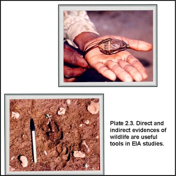
The faunal diversity was estimated using the direct and indirect evidences (pellets, droppings, scats, animal tracks and signs) along forest roads, human paths, river and stream beds. Information on presence/absence of different faunal group representatives in the area was further substantiated by information furnished by local people (Plate 2.3).
Estimation of existing level of biotic pressures such as cutting/lopping pressures, cattle grazing and hunting of wild animals was made. Cutting and lopping of tree species was quantified within the vegetation sample plots, by recording the total number of trees within predetermined sample plots. A score of 1-4 was assigned for different percentages, where 1 indicated 0 - 25% of lopping and 4 indicated 75 - 100% of lopping pressure. In addition, observations of number of people engaged in wood cutting/lopping and number of livestock seen within the forest areas were also made.
2.3.2 Grasslands
Grasslands are extremely important terrestrial habitats as they provide natural pastures for grazing species. Grassland habitats support characteristic floral and faunal values which would be prone to changes associated with proposed project.
The proposed pipeline route is aligned through the grassland area near Sinnar. Floral and faunal characteristics of this grassland were recorded within 1 m radius circular plots.
2.3.3 Wetlands
Wetland is a collective term of ecosystems where formation has been dominated by water and whose processes and characteristics are largely controlled by water. High biological productivity, plentiful supply of water, and diverse flora make wetlands home for a variety of birds, reptiles, amphibians and fishes. These enigmatic systems are also crucial for critical stages of biological cycles such as breeding, nesting (aquatic birds) and spawning (fishes) sites (Anon, 1983).
Hydroperiod is defined as the periodic or regular occurrence of flooding and/or saturated soil condition (Cowardin et. al., 1979). The frequency, depth and duration of the water's influence determines to a significant extent, the flora and fauna present and the function that the wetland provides. Water, whether it is from the surface water source or from ground water is the most critical feature for an effort to define, evaluate and reproduce the biological values of naturally occurring wetland systems (Marble, 1992). In total, 12 types of hydroperiods (four tidal hydroperiods and eight non-tidal hydroperiods) have been referred (Fig 2.2) based on Cowardin et. al. (1979) to evaluate the biological values of existing wetlands en route the proposed pipeline expansion.

Creek
The proposed Bombay-Manmad Pipeline route traverses through the Ulhas Creek. The two banks of the creek were surveyed on foot for distance of 1 km to assess the status of existing faunal groups including fishes, turtles and migratory water fowls. Physical characters (depth and width) and existing bank vegetation were also recorded.
Lake
Wetlands formed on the lake margins, extending from the shallow littoral zone out to the deeper limnetic zone, to the extent that light penetration supports diverse floral and faunal species. The majestic royal bengal tiger of the sunderbans and the highly endangered Manipur Brow Antlered deer in the swamps around Loktak lake are prominent examples of the fauna that, these ecosystems can support (Anon, 1992).
The proposed pipeline route is aligned along the periphery of Lake Beale. The pipeline route along lake was surveyed on foot for a distance of roughly 2-3 km. Fish fauna of this lake was recorded by direct observations of the catches made by the
fisherman during the survey period. The information on migratory waterfowl was also gathered through secondary information sources.
River Corridor
River corridor survey (RCS) has been developed based on the National Rivers Authority (NRA 1992). A river corridor consists of stretch of river, its banks and the adjacent land (about 50 m wide). Different parameters which have been recorded for three zones (Table 2.3), include features of the river, bank zone habitat, biological productivity, adjacent landuse, aquatic fauna, level of biotic disturbances and industrial activities in the vicinity.
Table 2.3 River Corridor Survey Zones
|
Zone
|
Parameters recorded
|
|
Aquatic
|
Flow and current features: Low, moderate and high Physical features: Width and depth Substrate: Sandy, muddy, rocky bottom Wildlife values: Aquatic species (Fishes, Amphibians, Reptiles, Birds and Mammals)
|
|
Bank
|
Tree species and other associated plant communities
|
|
Adjacent land
|
Habitat types/landuse
|
Godavari River
The proposed pipeline route traversed through Godavari River Corridor. The river corridor was surveyed on foot for a distance of approximately 1 km both upstream and downstream of pipeline crossing point. Information on aquatic flora and fauna (fishes, reptiles and birds) and existing sources of biotic pressures was collected during the survey. Physical characteristics (width and depth) of the river, the bank vegetation and landuse pattern in the adjacent areas was also recorded.
|


