|
From the functional or economic view point, the necessity to use pipelines as mode of transportation for petroleum products can not be understated. However, while development and expansion of such utilities provide substantial benefits, the significance of their ecological impacts and the resilience of natural habitats must be fully and properly taken into account in the planning process. It is with this fundamental objective, the EIA study of Oman - India Gas Pipeline Project was conducted.
In natural ecosystems the impacts of project actions occur on floral and faunal species. The impacts of more general nature are related to changes in community types and their geographical distribution. Specific impacts may include changes in the life cycles of rare and endangered species inhabiting the area. The first step in the process of prediction and assessment of impacts on the biological environment involves the preparation of adequate database from the ecological and biological perspective. This section of the report discusses the data needs and associated methodology for generating information on vegetation patterns habitat characteristics and faunal components.
The foremost tasks that can be outlined for the proposed study include:
i. Comprehensive overview of both the proposed project and its potential impacts.
ii. Consideration of proposed activities in all phases of the project and identification of critical environmental concerns.
iii. Identification of primary categories of habitats en route the pipeline corridor.
iv. Generate information on habitat quality and characteristic faunal components of the identified habitats.
v. Prediction of the critical impacts both quantitatively and qualitatively whenever and wherever possible.
vi. Provide project evaluation, incorporating the environmental safeguards and mitigatory strategies.
The following techniques have provided the diverse information needed for the assessment of the impacts of the Oman - India Gas Project on Wildlife.
2.1 DOCUMENTED INFORMATION
The project description, design and details, route maps and toposheets formed the basic material that aided in developing the understanding of the project environment and the biological components that need to be studied in relation to the Oman - India Gas Pipeline Project. Published papers in technical journals, conference proceedings and reports and records from local and state agencies such as wildlife and forest departments and Survey of India, research documents and published and unpublished reports of wildlife surveys undertaken in the recent past in the region has helped a great deal in compiling the ecological information of the areas en route the pipeline prior initiation of indepth field based studies.
2.2 RECONNAISSANCE
Once the route selection procedures have been completed to provide the final route that the proposed pipeline would follow, reconnaissance in the project were useful means to determine sites and parameters to be studied in greater detail during the detailed field investigations. A reconnaissance of the entire length (165 km) of pipeline from landfall point near Rapar Gadhwali (Plate 2.1) to receiving terminal near Bhachau (Plate 2.2) was undertaken initially for location and grid referencing of areas of ecological significance. Survey points were located randomly within the proposed pipeline corridors. Target notes were prepared in brief for each survey point. These notes provided a broad based information on characteristics and understanding of the ecological importance of aquatic and terrestrial habitats en route the pipeline.
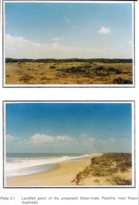
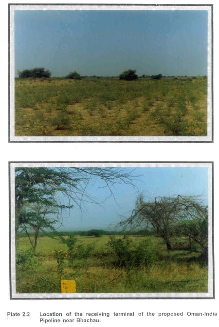
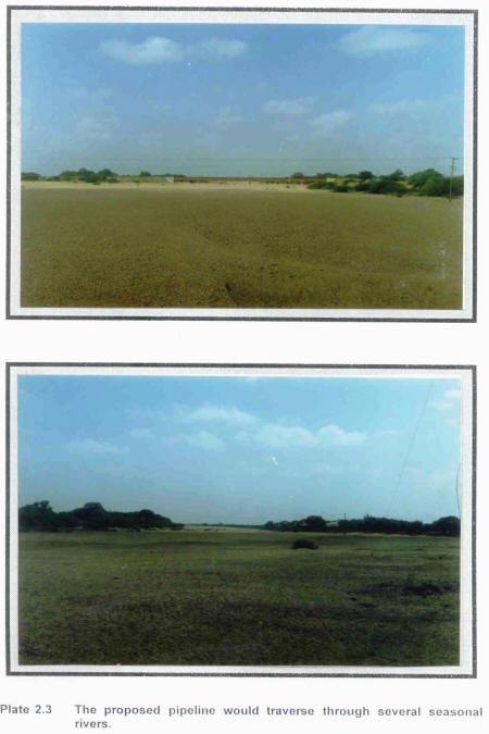
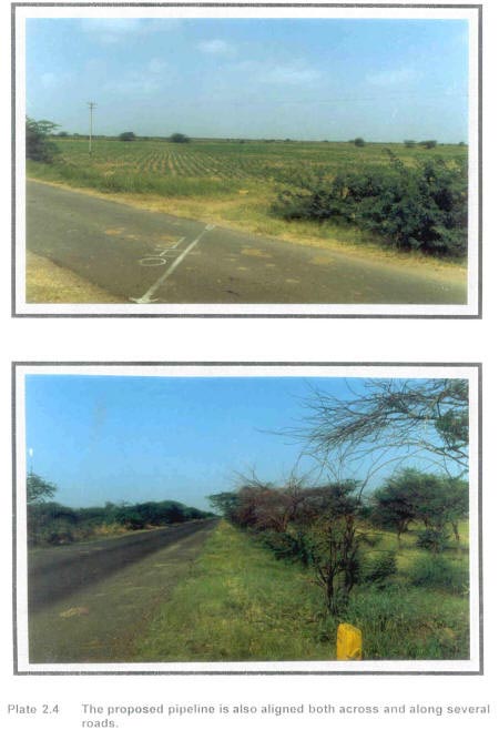
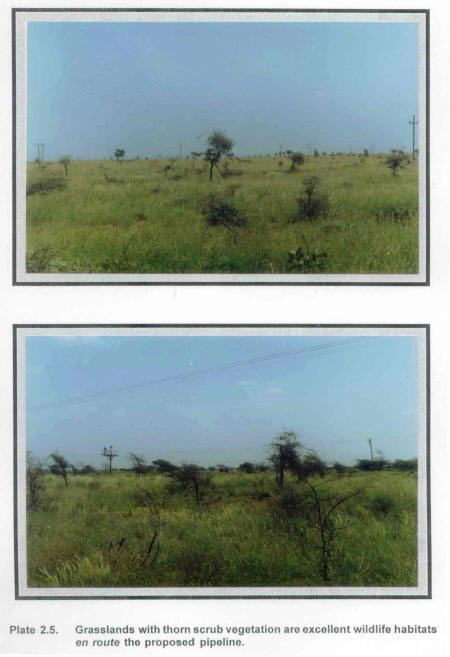
A total of 19 survey points were located during the rapid assessment survey (Table 2.1). For each of these points, details including chainage numbers and turning points, landuse category and wildlife value were recorded. The forest habitats identified during reconnaissance included dense scrub jungles near landfall point (Plate 2.1) and open scrub jungle in ravines. The proposed pipeline would also traverse several rivers (Plate 2.3) and roads (Plate 2.4). Grasslands with thorn scrub vegetation are also some of the excellent wildlife habitats en route the proposed pipeline (Plate 2.5).
Table 2.1 Sample points located during the rapid assessment survey.
| S. No. |
Nearest location |
Landuse\Legal category |
Wildlife values |
| 1 |
Rapar Gadhwali (Landfall point) |
Coastal area with dense scrub |
+ |
| 2 |
Pingaleshwar Temple CH=2.25 |
Open scrub/grassland |
+ |
| 3 |
Rapar Gadhwali CH=3.188 |
Naira river |
- |
| 4 |
Sahera village CH=14.44 |
Agri. land |
- |
| 5 |
Sandhav village CH=23.36 |
Agri. land |
- |
| 6 |
Mothala village CH=38.10 |
Agri. land |
- |
| 7 |
Sanosara village CH=45.46 |
Open scrub in ravines |
+ |
| 8 |
Sanosara village CH=47.73 |
Agri. land/Open scrub |
- |
| 9 |
Sanosara village CH=51.57 |
Agri. land |
- |
| 10 |
Bhibhapar village CH=54.98 |
Grassland/Open scrub |
+ |
| 11 |
Vibhapar village CH=57.76 |
Agri. land |
- |
| 12 |
Deshalpar village CH=71.56 |
Agri. land |
- |
| 13 |
Mankuwa village CH=84.2 |
Agri. land |
- |
| 14 |
Sukhpur village CH=92.75 |
Agri. land/Open scrub |
- |
| 15 |
Kukma village CH=106.94 |
Agri. land/Open scrub |
- |
| 16 |
Kanyabe village CH=131.44 |
Agri. land/Open scrub |
- |
| 17 |
Chandrani village CH=143.19 |
Sang Nadi |
- |
| 18 |
Sukhpar village CH=156.11 |
Agri. land |
- |
| 19 |
Sikara village CH= 168.29 (Terminal point) |
Agri. land |
- |
2.3 INTENSIVE STUDIES
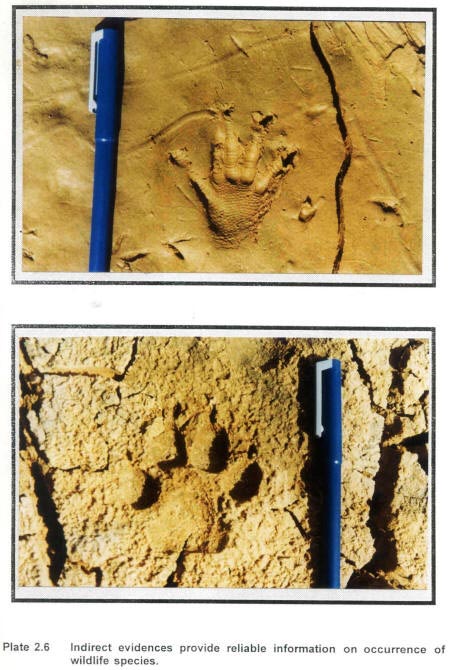
The wildlife habitats identified during reconnaissance survey were revisited for collecting detailed baseline information on pre-project natural environment of the project area through select parameters. During this period, relevant information on the habitat features, vegetation characteristics and structure, and faunal status was collected using descriptive and quantitative techniques (Giles, 1972 and Sale and Berkmuller, 1988). Direct and indirect evidences (Plate 2.6) of wildlife species in the pipeline corridor and the secondary information on occurrence of a particular species illicited from local people were relied on for ascertaining the existing status of wildlife values in different habitats.
For the evaluation of project impacts on wildlife values within the pipeline corridor, the baseline information thus generated would be used to predict anticipated changes in one or all of the impact indicators and also their magnitude or scale so as to consider their significance in negating wildlife conservation efforts.
|


