Methodology
|
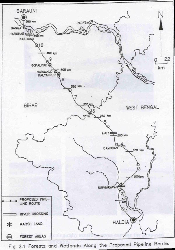
The usefulness of the environmental impact assessment of the major development projects has been well recognised both by the project planners and the decision makers for the sound environmental management. It is for this reason that environmental impact assessments have become a mandatory requirement for meeting the statutory provisions for environmental clearance of development projects. EIA is a procedure which provides the opportunity for identifying, mitigating or enhancing the potential environmental, health and social consequences of a proposed development activity (Johnstone, 1986). Measurement of the state of environment through a set of predetermined parameters prior to initiation of the project is an essential prerequisite for predicting impacts of any development project. It is needless to emphasize, that the baseline information on the existing status and trends of the environment is a crucial yardstick for the assessment of the probable changes in the environmental quality. Reliability and the robustness of the predictions of the likely impacts of the proposed developmental projects only ensure better mitigation planning (Dixon et al., 1983). This chapter outlines the procedures adopted for the prediction and evaluation of the impacts of the proposed Haldia - Barauni Pipeline Project on wildlife and their habitats. 2.1 MACRO LEVEL ASSESSMENT A macro level assessment was initially done to designate the areas of ecological interest. Secondary information on the status of forests and wildlife enroute the proposed pipeline was obtained from the records of the State Forest Departments of West Bengal & Bihar and from the recent wildlife literature (Rodgers & Panwar, 1988; Choudhry & Bhupathy, 1993; and Directory of Indian Wetlands, 1993). Identification of forests, marshlands, rivers and other wildlife habitats enroute the pipeline was done with the help of the maps prepared by NRSA based on IIRS-LISS-II data and Survey of India toposheets of 1:50,000 scale. For this purpose, the entire proposed pipeline route was divided into 11 linear segments of approximately 50 km length. The number of ecologically sensitive areas/wildlife habitats were identified within each of these segments (Fig 2.1). Relevant information on the project design of the proposed pipeline project and the choice of technology that would be used for laying the proposed line along bridges, canals and across the rails and rivers was collected from the Authorities at IOCL and EIL offices in New Delhi, Haldia and Barauni.
2.2 RAPID ASSESSMENT SURVEY 2.3 INTENSIVE SURVEYS
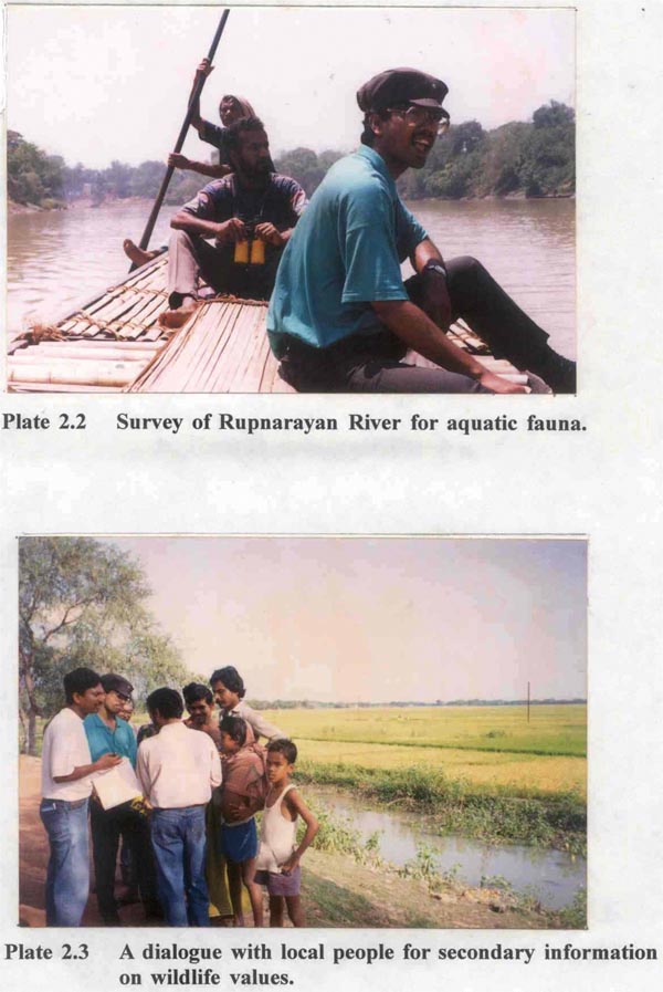
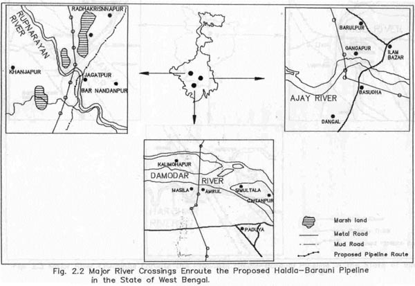
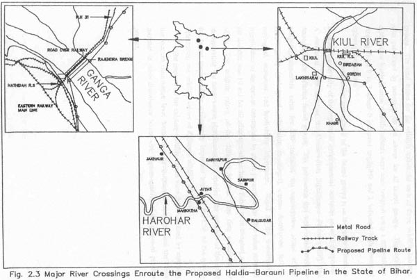
(i) Forests (ii) Wetlands As mentioned earlier, the pipeline crosses six major rivers. These rivers were surveyed intensively. The Ganges and Rupnarayan rivers were surveyed using boats (Plate 2.2) for collecting information on aquatic wildlife (dolphins, water birds, crocodiles, turtles etc.). During the river survey, these two rivers were surveyed for a distance of about one Km upstream and downstream from the survey points at which the proposed pipeline route indicated river crossing. For other rivers (Kiul and Damodhar) surveys using boat were not possible because of the extremely low level of water in the rivers. These rivers were surveyed on foot, for a distance of roughly 1.0 km along the banks of the rivers. Fish fauna of these rivers was recorded by direct observations of the catches made by fishermen during the survey period and from secondary information (local fishermen and literature review). The existing status of crocodilians and turtles in all these rivers was determined on the basis of secondary information generated from the informal dialogue with the local villagers (Plate 2.3) and from the relevant wildlife literature (Jhingran, 1991; Rodgers & Panwar, 1988; Choudhry & Bhupathy, 1993; Directory of Indian Wetlands, 1993). The marshes could not be surveyed intensively due to inappropriateness of the time for such surveys. These marshlands are seasonal and the only appropriate time for their survey would have been any period between October and February. These marshes were being used as agricultural lands during the study period and so the collection of data on wildlife values of these marshes could not be made possible. However, the secondary information on the status of these marshes and their wildlife values was obtained from local people. 2.4 ANALYTICAL METHODS The wildlife values of all the wildlife habitats were evaluated using the scale weighing approach. Scores were assigned to the faunal groups (fish, turtles, crocodiles) in all the wildlife habitats. The scores ranged from 0 to 3 where 0 indicated no wildlife value and 3 indicated high wildlife value. The high and low values for wildlife were based on the richness of the faunal groups. The total scores for the wildlife values for each of these wildlife habitats was calculated by summing up the scores for all faunal groups. The existing disturbance levels in these wildlife habitats were scale weighed using a score values ranging from 0 to 3 where 0 indicated negligible and 3 indicated high levels of existing disturbance. The conservation significance of the faunal groups is an important criteria to evaluate the severity of the impacts of developmental activities on wildlife species. A numerical value denoting the Conservation Significance Factor (CSF) was determined for different faunal groups. The parameters that were considered for assigning numerical value for CSF included the conservation status of the species/group (endangered, vulnerable, threatened), current distribution, and the ecological, economic and biodiversity importance. Based on the conservation significance of the species determined by above parameters the CSF value assigned for dolphin was 10 and for all other species excluding fishes were assigned a value of 5. The wildlife values of the different habitats were then calculated by incorporating the conservation significance of a species. The products of the score for faunal species of the ecologically important areas and the CSF of the species determined the wildlife values of different wildlife habitats. The impacts on the existing wildlife values were then visualised by assessing the current disturbance level from other developmental activities and the likely increase in these disturbance levels with implementation of the proposed pipeline project. |
Last Updated: October 7, 2015


