Baseline Status
|
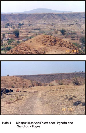
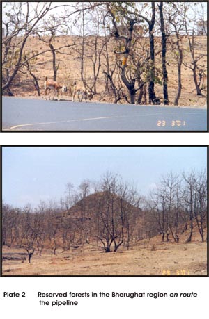
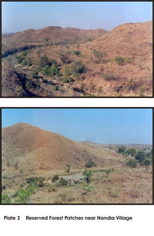
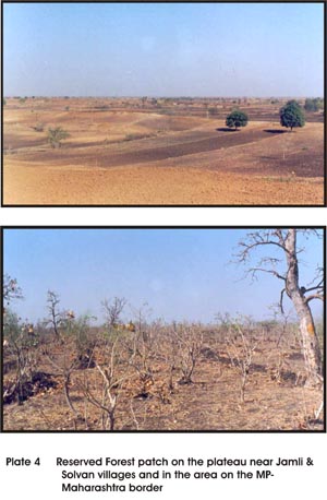
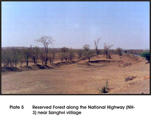
The cross country pipeline in its 357 km long stretch between Manmad and Manglya traverses through several land use including cultivated areas, fallow agricultural areas, forests, wetlands (rivers, reservoirs and wetlands). The other important land features en route the pipeline include canals, national and state highways and railway crossing. In its entire stretch the pipeline traverses through 268 km of cultivated land in plains and 87 km in hilly and rocky terrain. Within the pipeline corridor, 28.62 km of forested tract, 21 major rivers and 3 reservoirs represent the terrestrial and aquatic ecosystems. 3.1 Forest Ecosystems These forest areas have been the working coupes of the forest department in recent past. The Dhal forest near Bhurakura and the forests of Dhamnod range near Junapani village which are comparatively better stocked, support a few species like the jackal, fox, wild boar and hare. Rocky terrain, fragmented landscape, high biotic pressures and the coupe in operation have resulted in fairly low wildlife habitat potential of this area. The forest areas of the Bherughat region and the Jamanjiri area form almost a contiguous patch with the Bhurakua forest patch except for their bifurcation by the NH3 (Plate 2). The disturbances associated with the construction of an approach road for Nayapura and Ambapura villages, coupe in operation and the alignment of the national highway abutting these forests have greatly reduced the potential of these open mixed deciduous forests as a terrestrial wildlife habitat. The forest tract beyond Jamanjiri extending almost upto Nandia village (Plate 3) also present a fragmented landscape largely dominated by scrub forest interspersed with cultivated areas. A small perennial stream near Nandia village supports a riparian patch of forest dominated by Syzgium cumini, Terminalia arjuna, Pongamia pinnata and Ficus species. The biotic pressures and dependence of local community on riparian forests for fuel and fodder resources have resulted in highly degraded ecosystem. The forests beyond Nandia village located in Palasner near Solvan village at the interstate border are largely plantations raised on forest land (Plate 4). These plantations of Butea monosperma, Acacia catechu and Parkinsonia asculata are being heavily exploited for fuel wood demands of the resident tribal communities. The forest areas near Sanghvi village along the National Highway NH – 3 are plantations of Acacia catechu (Plate 5) that have little potential to support wildlife. The remaining forest patches in the state of Maharashtra are fragmented and barren areas under plantations. The existing biotic pressures and increasing threats from anthropogenic influences have resulted in depletion of most terrestrial habitats both in terms of spatial limits and their suitability for wildlife species. As a result, their wildlife values are fairly insignificant. This becomes amply evident from the habitat features and the wildlife values of individual forest patches presented in Table 3.1.
Table 3.1 Characteristics of forest ecosystem and their wildlife values
3.2 Aquatic Ecosystem 3.2.1 Conservation Values of Aquatic Ecosystem
The Narmada is the only perennial river with significant wildlife values of conservation significance.
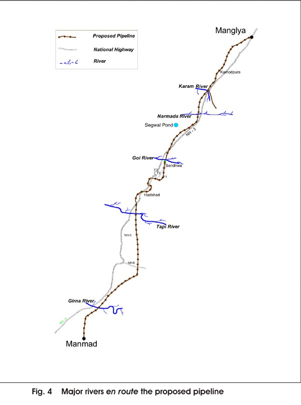
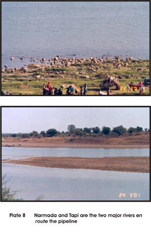
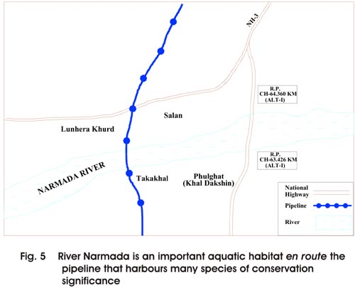
* These areas are not traversed by pipeline Narmada, arising on plateau of Amarkantak in Shahdol district of Madhya Pradesh is perhaps the largest west flowing river in Indian peninsula. The river traverses a 1312 km course to the Arabian sea through forested hills and rich agricultural lands. The proposed pipeline route traverses this river near Takakhal (Fig. 5). The pipeline is aligned to traverse the river for a width of 590 meters, downstream of the bridge crossing on NH-3. The aquatic values of Narmada are fairly well understood (Sabnis & Amin 1992; WII 1994; FONS 1994). The river supports a wide variety of invertebrate fauna (Sabnis & Amin, 1992) and is also a home to the highly endangered species of aquatic mammal, the otter (Lutra perspicillata). The river is also known to be a habitat of several species of fresh water turtles, such as the soft shell turtles (Chitra indica, Aspideretes gangeticus and Lessimys punctata) and hard shells such as Kachuga tecta and Kachuga tentoria. Occurrence of mugger crocodile (Crocodylus palustris) has also been confirmed in Narmada (WII 1994). The riparian and riverine stretches of Narmada have a great potential to support diverse bird communities. Thirty species of birds were recorded during the surveys conducted by WII team in stretch upstream and downstream of the Narmada Dam location (WII 1994). Since the wildlife values of the stretch to be traversed by the pipeline was not significantly different from that studied earlier (WII 1994), efforts to conduct fresh aquatic surveys were not made. The information collected by WII team during the aquatic survey for EIA of Narmada dam provided a reliable and robust baseline information for reference in the evaluation of project impacts on the river stretch to be traversed by pipeline. Efforts were however made to visit the stretches of the river likely to be affected by this project to collect information on trends of disturbances associated with landuse practices in the vicinity of its banks. Prevailing practices of brick kilning on the banks of the river, fishing, and encroachment of river banks for agriculture have continued to modify the riparian habitat characteristics and pose challenges to species conservation. The disturbance associated with this project could be an additional source of disturbance to the riverine ecology of Narmada. Therefore, wildlife values of this river merit careful consideration in impact assessment.
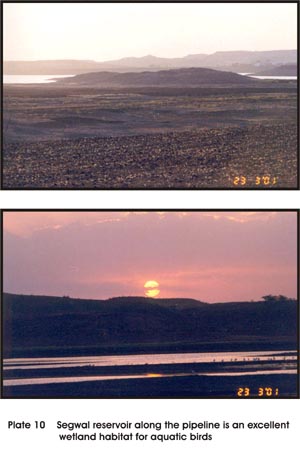
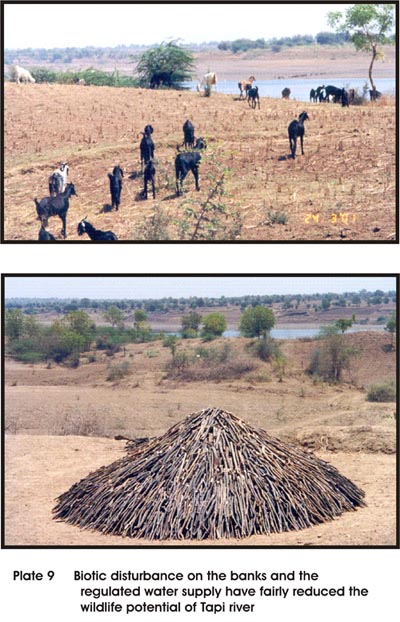
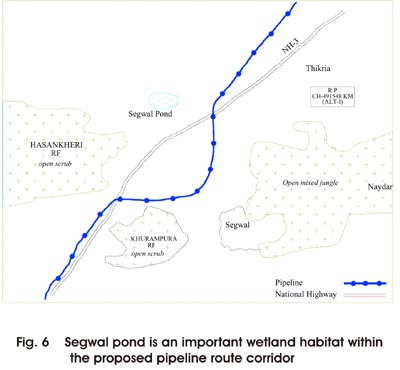
Tapi is another major perennial river in the pipeline route corridor. The conservation value of this riverine habitat has been greatly affected by the regulation of water from the dam located upstream. The river has several dry stretches for prolonged periods that render it unsuitable for supporting diverse wildlife species. Fuel wood collection and grazing pressures on its banks are additional sources of potential threat to the suitability of its habitat for wildlife (Plate 9). The Segwal pond located in close proximity of pipeline (Fig. 6) is an excellent habitat for a wide variety of birds. During the field visit a larger number of birds were sighted in the reservoir. Adequate water, plentiful fish resource in the pond and agricultural fields surrounding this water body attract large number of birds. Some of the birds sighted during the field visit are ruddy shelduck (Tadarna ferruginea), spoonbill (Platalea leucorodia), large egret (Ardea alba), little egret (Egretta garzetta), little ringed plover (Charadrius dubibus), common sandpiper (Tringa hypolencos), red wattled lapwing (Vanellus indicus), blackwinged stilt (Himantopus himantopus) & whitebreasted kingfisher (Halcyon smyrnensis). Despite the fact that the field visit was undertaken in early summer, several species of birds were sighted. It is thus logical to assume that this wetland is also an excellent habitat for winter migrants. A water fowl survey in the winter months would be worth the effort to establish its conservation value for recommending the area for inclusion as a site for the Asian mid - winter water fowl count and for promoting enhanced protection.
|
||||||||||||||||||||||||||||||||||||||||||||||||||||||||||||||||||||||||||||||||||||||||||||||||||||||||||||||||||||||||||||||||||||||||||||||||||||||||||||||||||||||||||||||||||||||||||||||||||||||||||||||||||||||||||||||||||||||||||||||||||||||||||||||||||||||||||||||||||||||||||||||||||||||||||||||||||||||||||||||||||||||||||||||||||||||||||||||||||||
Last Updated: October 7, 2015


