Limestone mining lease area
|
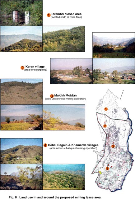
Land-use pattern: The mine lease area is spread over 725.855 ha and consists of 410 ha of mineral bearing area and remaining 315.855 ha of non-mineral bearing area. The entire lease area can be categorised into the following land-use classes: (i) Demarcated Protected Forest (DPF): The DPF area is represented by a total of 284.16 ha comprising about 154 ha of Tarambri DPF, approximately 26 ha each of Keran and Drahal DPF, 57 ha of Bali Baderan DPF and 21.33 ha of Maloh DPF. The mineral-bearing area within the DPF is limited to 151 ha spread over the north and south blocks of the mineralised area. (ii) Government land occupies 183.16 ha in the mining lease area of which the mineral-bearing area occupies 125.5 ha. The land-use in this category comprises charagan which are common pasturelands used by the villages primarily for obtaining fodder for livestock and also for fuelwood to meet their energy requirements. (iii) Private land occupying 258.535 ha consists of the agricultural fields and housing settlements of the villages of Keran, Mulakh Maidan, Behli and Bagain (Fig. 8). The mineral-bearing area occupies 133.5 ha in the Private Land. The agricultural fields of these villages produce two main cropping seasons of kharif and rabi. Rice is the main kharif crop grown over the monsoon season particularly in areas that have irrigation facilities such as Keran village. The rabi or winter crop is chiefly wheat. Other crops such as lentils, maize and vegetables such as tomatoes, chillies, brinjal, along with fruit yielding trees of mango (Mangifera indica) and amla (Emblica officinalis) are also reared in the area.
The area currently under mine lease would be transformed into an operational mine. A total of 277 ha of land will be used for mining of limestone, while another 97 ha will be used for dumping of overburden and waste rocks. Associated infrastructure such as offices, workshops, parking lots and garages for vehicles will take up about 50 ha of land in the lease area. The following table (Table 5.1) presents a break-up of the lease area in different land-use categories and the future use during mining and post-mining operations. Table 5.1 Existing and future land-use within the mining lease area
Ecological profile and conservation value: The proposed limestone mining lease includes areas of grassland, scrub and forest that provide habitat for various species of flora and fauna. These provide a mosaic of habitats that support mammals such as common Indian mongoose (Herpestis edwardsi), rhesus macaque (Macaca mullata), jungle cat (Felis chaus) and a variety of birds particularly galliformes such as the Kalij pheasant (Lophura leucomelanos), Indian peafowl (Pavo cristatus), red junglefowl (Gallus gallus) and black partridge (Francolinus francolinus). The Demarcated Protected Forest (DPF) land falling within the lease is under pressure from human interspersions, resource extraction by surrounding villages and livestock grazing. The Tarambri DPF adjoining the northern boundary of the lease area is relatively better protected habitat of conservation interest. |
||||||||||||||||||||||||||||||||||||||||||||||||||||||||||||||||||||||||
Last Updated: October 5, 2015


