Study area
|
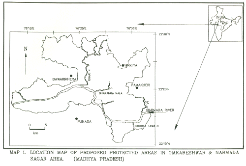
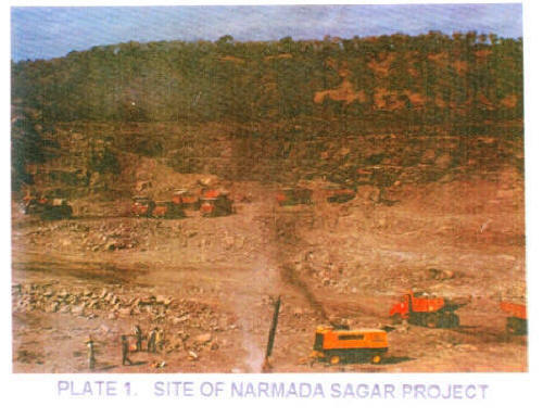
The area lies in the central India state of Madhya Pradesh. It is between 76012’30” to 76040’ East longitude and 22010’ to 22030’ North latitude. The are falls under two geological formation viz. on the Northern side of the river Narmada is main Vindhyan Range and on the southern side is the Satpura range of Deccan Plateau. Narmada Sagar Project is one of the several projects being built on the river Narmada. A large area is gong to be submerged which include forest and agricultural areas. It will have full Reservoir Level at 262.13 m at m.s.l. and Mean Draw Down level at 243.23 m. It is aimed to irrigate 2.65 lakh ha of land and to generate 1000 MW of hydel power with a view to bring prosperity to the state and nation (Anonymous, 1992) (Plate 1). Proposed protected areas are in two districts viz. Dewas and East Nimar (Khandwa) (Map 1). 2.1.1 Rainfall and Humidity The rainfall varies from 1000 to 2000 mm per annum. Narmada basin gets an average annual rainfall of 1288 mm. Rainfall starts with the onset of South-West monsoon sometime in June and continues up to the middle of October. Dry period is from November to May with occasional rainfall in between. Highest rainfall is during June to August and in the remaining 8 months rainfall is up to 60 mm. Humidity is low in the area, averaging 50% when compared to the neighbouring zones of Deccan plateau. 2.1.2 Temperature The study area comes under very dry zone. During summer temperature rises up to 480C. May is the hottest month. The annual mean maximum lies between 290C to 350C and the annual mean minimum lies between 180C to 230C. 2.2 GEOLOGY The ocean plateau is one of the oldest and is a very stable block of the earth surface compared to the Himalayas. The Vindhyan formations where teak is predominant consists of sandstones and semi-quartzites. Shales and lime-stone. Quartzites of reddish colour with small interbeddings of san stone of purple colour bedding to Vindhyans (Super Group) occur in these formations. The study are of the project generally encompasses the Narmada stone lineament. The area being composed of massive and compact basaltic lava flows of 6.5 m to 30m thickness at lower depths with presence of vesicular and amygdaloidal and appreciable weathering on the top known as the Deccan trap (Anonymous, 1992). 2.3 SOIL Parent rock is essentially in the teak forests. Soils are basic, alluvial, ferruginous, black soil on traps and thus are lateritic and well drained. The soils on subdued hills are dark reddish brown to dark brown, coarse in texture (‘murrum’) and occasionally gravel and shallow to moderately deep. These are highly erodible soils. The soils in the plain table land are darker in colour and moderate to very deep. Texture is fine. These are good for intensive cultivation.
|
| Inside cover | Preface | List of maps | List of plates |
| List of tables | Introduction | Study area | Compartment map of the proposed protected areas |
| Vegetation mapping | Landuse mapping | Geomorpho-logical mapping | Conclusion |
| References |
Last Updated: January 21, 2014


