Compartment map of the proposed protected areas
|
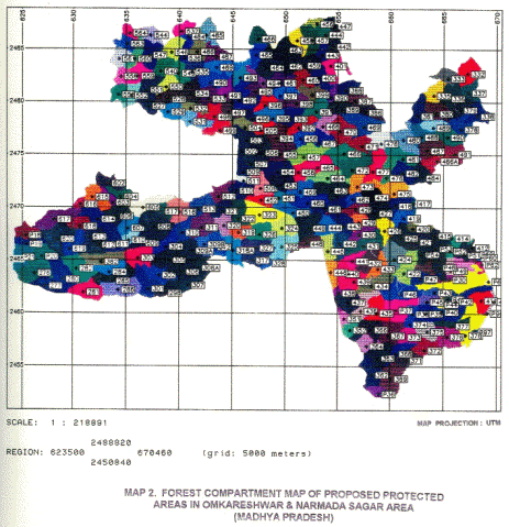
Forests, by and large, in India are managed by State Forest Departments. Each state has got a hierarchical system of managing forests. Forest compartment is the smallest unit of management. A group of compartments make one block and several blocks form the forest range. Management operations are done at the compartment level and history of each compartment is periodically maintained. These records are of immense value for comparison and production cycling. As a matter of practice these compartments are well defined on the ground by permanent natural features viz. ridge, stream and where necessary by boundary pillars. The area details are organized by compartments and blocks. 3.1 OBJECTIVE To depict the forest compartment boundaries falling within the proposed protected areas. 3.2 METHODOLOGY (i). Materials used for the extraction of the compartment map were Division Forest Maps. PPAs cover two Forest Divisions – Dewas Forest Division and East Nimar (Khandwa) Forest Division. NVDA and FONS provided the input compartment maps. 3.2.2 Database creation Compartment map was digitized using GRASS software to create database for further analysis of GIS. Conservation of flora and fauna requires a viable area for these to grow, flourish, breed etc. Determination of this parameter is a very complicated process. The PPAs have dry deciduous vegetation and support diverse flora and fauna. Since a large area of the forest would be lost due to submergence, enough care was taken to include good forested areas in the protected area network and leave some compartments for the different forestry operations. A total of 284 compartments from two forest divisions have been included in the proposed PA (Map 2).
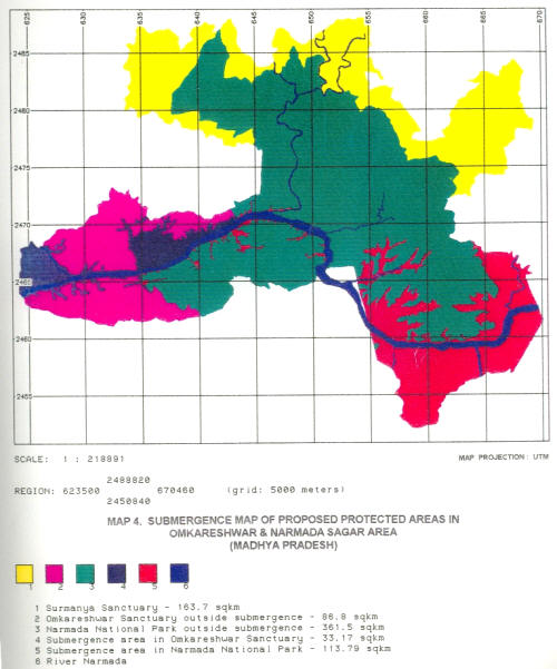
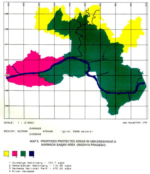
3.3.1 Forest Division Under Study Area The jurisdiction of the proposed protected areas falls in two districts i.e. Dewas and E. Nimar (Khandwa). It comes under two forest divisions – Dewas Forest Division and Khandwa Forest Division. Some area of Hoshangabad District is also going to be inundated, which is, however, out of the limits of the present PPA. Total forest are going to be submerged is tabulated in Table 1 (Map 5). Table 1. Submergence area* in different forest ranges
* Based on FONS report.
3.3.2 Area Analysis of PPAs The proposed protected area has been divided into 3 parts. The main area, to be called as Narmada National Park covers an area of 475.22 km2 (62.2%) which is more than half of the total area. Two other areas, to be called as Surmanya Sanctuary and Omkareshwara Sanctuary, have an area of 163.70 Km2 (21.57%) and 119.96% km2 (15.8%) respectively. The main aims of proposing these sanctuaries would be to have some protected area as “buffer” on the periphery of the proposed Narmada National Park. Surmanya Sanctuary on the northern boundary will have two parts, whereas Omkareshwara Sanctuary is on southern side of river Narmada and forms the south-west boundary of the park. It is envisaged that these sanctuaries will absorb certain amount of biotic pressure. Table 2 gives the area details of these PPS (Map 5). Table 2: Area details of the Proposed Protected Area (PPA)
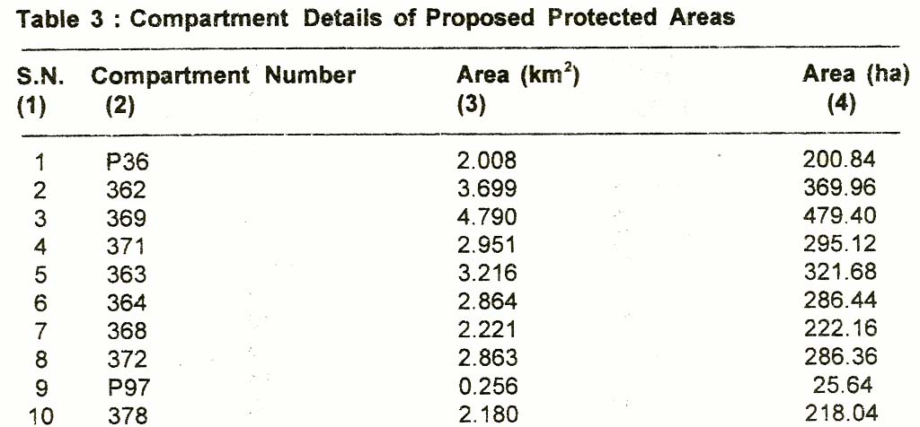
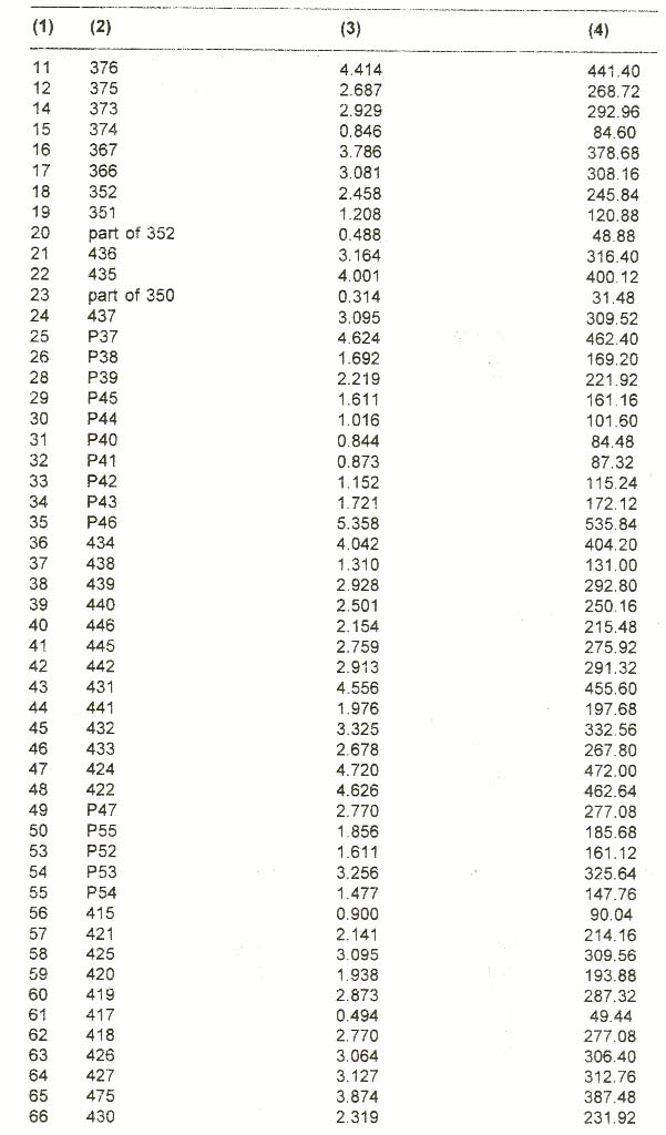
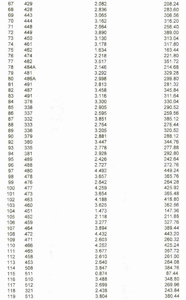
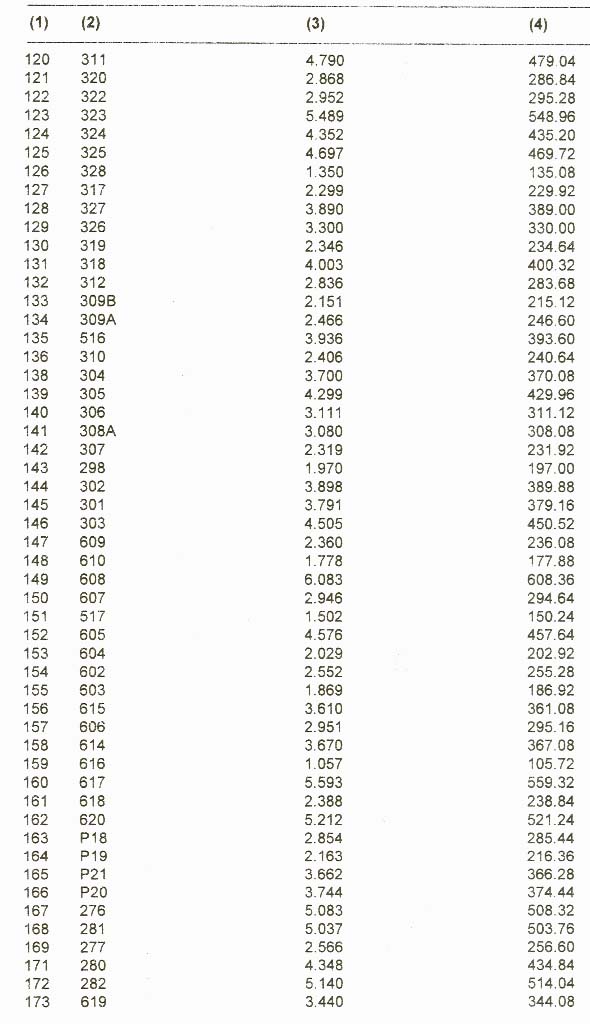
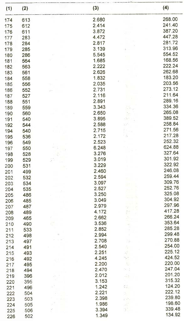
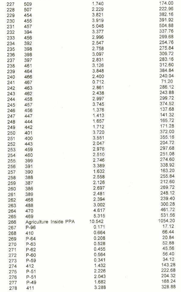
3.3.3 Area under different forest compartment A total of 284 forest compartments coming under East Nimar and Dewas forest divisions have been considered for declaring the three PPAs. Area analysis given in Table 3 is based on the analysis done in GIS domain on GRASS after the digitization of the compartment boundaries. Following is the statistics about the compartment which are being considered for protection (Map 2).
|
| Inside cover | Preface | List of maps | List of plates |
| List of tables | Introduction | Study area | Compartment map of the proposed protected areas |
| Vegetation mapping | Landuse mapping | Geomorpho-logical mapping | Conclusion |
| References |
Last Updated: January 21, 2014


