
River valley projects
1.1 Project Brief
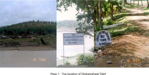
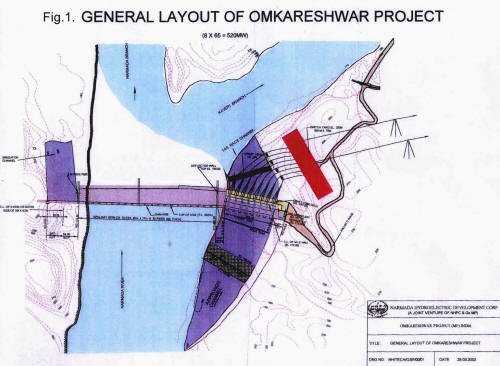
The Omkareshwar Multipurpose Project is proposed downstream of Indira Sagar Project (Plate 1) on the Narmada River, near Mandhata Village, District Khandwa. As per the design overlay(Fig.1)and the salient features(Table 1)provided by NVDA, the project envisages construction of a 73.12 m high and 949 m long concrete dam with gated spillway, to irrigate 1.468 lakh ha of C.C.A. through 142 km long L.B.C. and 64 km long R.B.C. and 83 km lift canal. The River Bed Power House of 520 M.W. installed capacity (8x65 MW) is proposed on the right bank of Narmada. The reservoir will have 0.242 MAF live storage capacity.
Table. 1 Salient features of Omkareswar Project
| Project location: | |
|
District |
– East Nimar, Khandwa |
|
Latitude |
– 21o14’25”N |
|
Longitude |
– 76o09’45”E |
| Concrete gravity dam | |
|
Total length including key (25.7 m) |
–949 |
|
Non overflow ( in meter) (110 + 35) |
– 145 |
|
Overflow portion Ogee shaped spillway (in meter) |
– 570.3 |
|
Power dam (in meter) |
– 208 |
|
Maximum height (in meter) |
– 73.12 |
| Radial crest gates | |
|
Number |
– 23 |
|
Length (in meter) |
– 20 |
|
Height (in meter) |
– 17 |
| Power house | |
|
Type of power house |
– surface |
|
Installed capacity (in MW) |
– 520 |
|
Type of turbine |
– Vertical Fracis |
|
Penstocks (Nos.) |
– 8 |
|
Diameter of penstock (in meter) |
– 7.66 |
| Benefits | |
|
Installed power (MW) |
– 520 |
|
Firm power generation |
|
| a) Initial phase (MW) | – 131.20 |
|
b) Final phase (MW) |
– 61.60 |
|
Energy Generation (GWH) initial stage |
Primary power 1166
Secondary power 468 |
|
Irrigation proposed (lakh ha.) |
– 1.47 (Left/Right Bank) |
| Reservoir Levels | |
|
Top Bund Level (TBL) (in meter) |
– 202.00 |
|
Max. water level (MWL) (in meter) |
– 199.62 |
|
Full Reservoir Level (FRL) (in meter) |
– 196.60 |
|
Minimum Draw Down Level (MDDL) (in m) |
– 193.54 |
|
Crest Level (Spillway) (in meter) |
– 179.60 |
|
Tail Water Level (TWL) (in meter) |
– Corresponding to PMF (186.50)
– Maximum (162.76) – Minimum (162.20 |
| Storage capacity | |
|
Gross B m3(Billion cumec) |
– 0.987 |
|
M.A.F. (Million Acre Feet) |
– 0.800 |
|
Live B m3(Billion cumec) |
– 0.299 |
|
M.A.F. (Million Acre Feet) |
– 0.242 |
|
Dead B m3(Billion cumec) |
– 0.688 |
|
M.A.F. (Million Acre Feet) |
– 0.558 |
| Submergence | |
|
Villages affected due to submergence at F.R.L |
– 30 |
|
Families affected (including major sons) |
– 4613 (as per 2002 survey) |
|
Population affected |
– 14474 (as per 2002 survey) |
| Land requirement | |
|
Cultivated area (in ha.) |
– 2,786 |
|
Other area (in ha.) |
– 4,521 |
|
Forest area (in ha.) |
– 5,830 |
|
Total |
13,137 |
Last Updated: February 7, 2013


