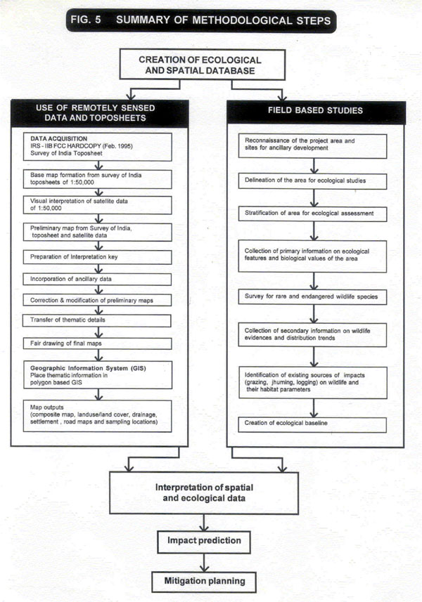
Creation Of Spatial Database
For the creation of a spatial database, satellitic data-IRS-IIB FCC Hardcopy (Feb, 1995) and Survey of India topographical maps on 1:50000 scale were acquired from respective sources. The base map was prepared using SOI topographical sheets and the interpreted satellitic data on landuse and landcover categories was transferred on the base map prepared earlier. Ancillary information and data obtained during reconnaissance was also transferred as spatial information. After necessary correction and modification of the preliminary maps, thematic maps were generated as outputs. Figure 5 provides an outline of the basic steps followed for developing the spatial database for the impact evaluation.

Last Updated: January 20, 2014


