ECOLOGICAL COMPONENTS
Landuse/Landcover
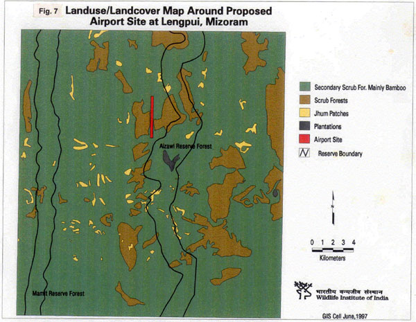
Forest is one of the principal landuse/landcover class of the project site and can be regarded as the most extensive primary natural resource of the area (Fig. 7).

The existing landuse cover of the project site is a result of several events occurring over a period of time. In the past, there used to be an small village forest attached to nearly every village for meeting the firewood, timber, fodder, bamboo, grasses and other needs. Subsequently, the forest areas were diverted for slash and burn (jhumming) cultivation. As a result, primary forests have almost become non-existent in the project area. Most of the forests seen today are of secondary origin. These forests are now degraded (scrubland) miscellaneous forests with mainly bamboo on the gentle and steep slopes. Areas with high biotic disturbances
on account of encroachment, illicit removal of fuelwood and timber, grazing, and ever shortening cycle of jhumming have been further transformed into scrubland with grassy patches. These forests correspond to the earlier "Tropical Wet Evergreen Forests" category of classification of Champion and Seth (1968). The man made forests in the project area are represented by the plantations of teak, gmelina arborea and rubber that are raised for supplementing fuelwood, timber and resources for forest based industries.
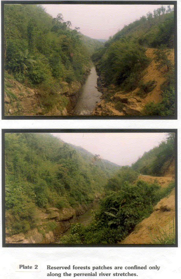
The entire landscape of the project area is dotted with jhum patches of varying sizes (Fig. 7). The seral vegetation that arises soon after the jhum field is abandoned consists of weeds, herbs, and a few surviving crop plants. Eupatorium adenophorum and Mikania scandens are common weeds. Woody plants are restricted to a few seedlings of Macaranga spp. and Mitragyna parvifolia etc. From two years onwards, the fallow is dominated by bamboo forests composed almost entirely of Melocanna bambusoides. Bamboo grows profusely in moist valleys and forms a closed canopy in five years or so. Woody plants sprout in the shade of the bamboo and in about 60 years or so, replace the bamboo vegetation (Ramakrishnan, 1992). Landuse/Landcover map made using remote sensing data and verified during the survey shows that jhumed areas (bamboo forests 5-10 year old) dominate the land area of the study site. The reserved forest fall outside the project area and are only restricted to 1/2 mile of the riverine zone (Plate 2) on either side of the rivers Twang and Gutur (Fig. 7).

Secondary forests, scrub lands and plantations together constitute the community forests or the village safety and supply reserves. These forests have been constituted for meeting various needs of the village.
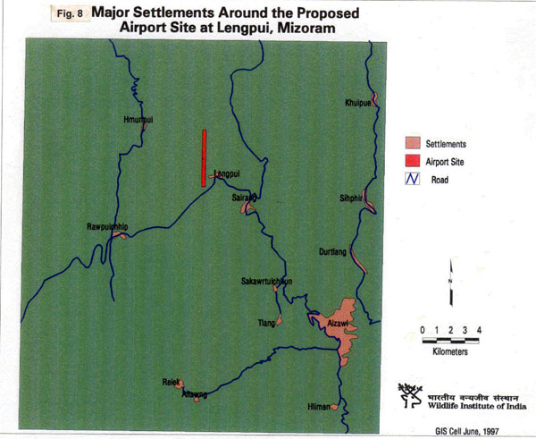
The proportion of area under built up land in the project area is largely the settlement area of Lengpui village with a population of 1808 in 355 households. The only other settlement which is about 7 km from airport by the shortest route is the township of Sairang with a population of 3527 (Fig. 8).

Last Updated: January 20, 2014


